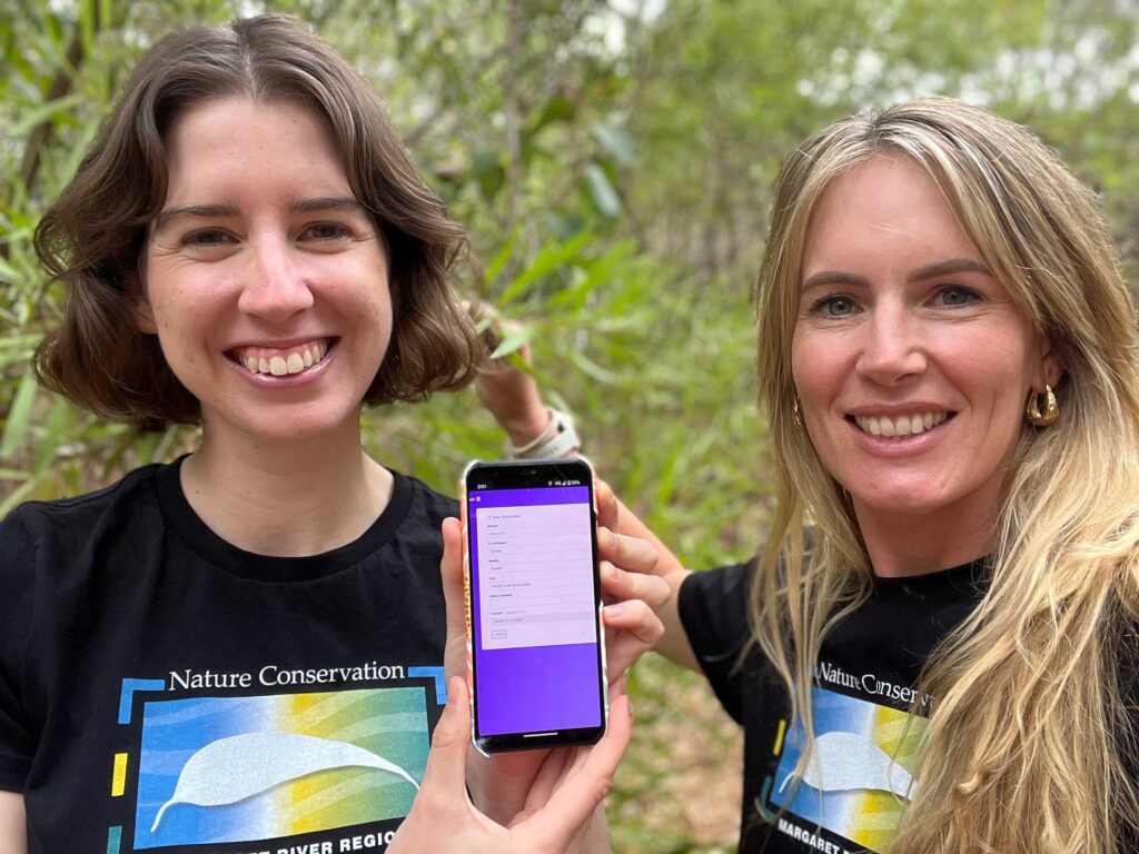
A new weed mapping citizen science project launched by Nature Conservation Margaret River Region is making a huge difference to our bush and biodiversity – but more people are urged to get involved.
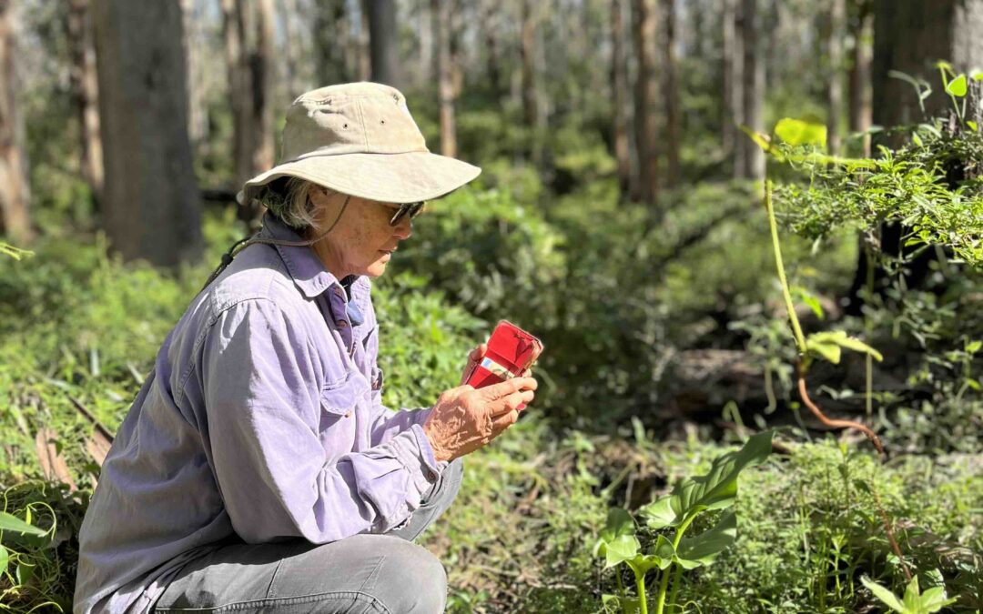
Anyone can download the free Fieldbook mobile phone app, which allows people to record target invasive weed species they see in any area of bushland, national park, road verge or reserve in the region.
More than 13 weed species can be reported, including arum lilies and all the highest priority non-native weedy weed trees that are a major conservation concern across the Margaret River region.
The information collated by Nature Conservation is being shared with community groups and government departments to help map infestations and identify priority areas. Weed mapping is also important to identify the extent of weed infestations, and zero in on threats to high priority areas.
Since launching the app in May, more than 9000 individual weed records have been submitted by more than 50 regular users in the community. And already maps generated using the data collected by volunteers are being used to direct arum lily control efforts in a more strategic way.
“Spring is a prime time for weed spotting, so we’re urging everyone to download the app and get involved,” says Nature Conservation biodiversity officer Obelia Walker. “Many of the priority weeds on the Fieldbook app hit list are flowering now, including arum lily, Sydney golden wattle, polygala, broom, and Victorian tea tree. It’s a great excuse to head out for a walk in your local bushland and map these weeds!”
Ms Walker said there were gaps in the data that Nature Conservation was hoping to fill. “If safe to do so, we are seeking weed data on roadsides as these areas are often a hot spot for weeds, acting as a seed source to adjoining land,” she says. “We are also hoping to engage more people in Dunsborough, Busselton and Augusta to download the app, helping to extend our mapping efforts and build a more comprehensive picture of weed presence and extent across the region.”
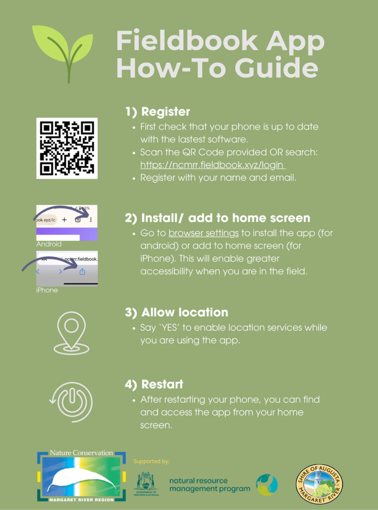
CLICK HERE for more detail including instructions on how to download and use the app or see the guide below.
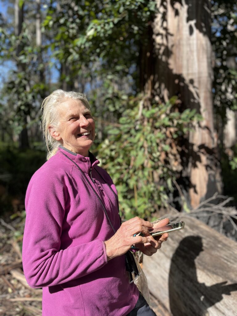
Among the weed mapping volunteers are local conservationists Ann Ward, Jen Wilksch and Jenny Kikeros. Jenny, a Friends of the Cape to Cape Track member, described Fieldbook as a “wonder” and a “real winner in so many ways”. “It is so easy to use and accurately maps arums and other invasive species,” she says. “Just click and it records. When you have finished, press ‘export’ and off goes the data to Nature Conservation. Nothing else to do.”
“The information is then converted into maps where it will help inform decisions on where control is needed. A highlight has been going back to areas and seeing what a difference the Arum Lily Blitz has made. Areas once ‘arum city’ are now returning to native vegetation,” Ms Kikeros says.
“Friends of the Cape to Cape Track volunteers have been going out and mapping and it has been great to hear back from them. They have commented on how easy it is to use and in areas they have been controlling they can see accurately how all their effort is making a difference.
“The app is a great excuse to appreciate our beautiful part of the world and give back. My friend, Michele, and I have been out in areas we have not been to for several years and re-connected. It’s a great opportunity to wander, chat, relax and calm the mind.
“How many solutions to problems have we found and what delights in the bush we have seen from the tiniest orchids to seeing cockatoos feeding and dropping nuts on our head. Why not go out with a friend, walk, talk and reconnect. It is so rewarding. I’m sure you will come back with a smile on your dial like we do.”
The data collected from the app will also help Nature Conservation fight for funding and resources to do more in the conservation space, she said. “Plus, it will help us argue the case for environmental weed control on public land and lobby government departments to take responsibility. And it will provide these organisations with a valuable resource for priority setting and monitoring,” Ms Walker says.
“It’ll also help with discussions with politicians and decision-makers. With our environment facing threats on all fronts and climate change starting to take a toll, there has never been a more important time to get involved with local, hands-on conservation like downloading this app, learning to identify weedy species, and uploading the info via the app.”